 |
|
|
|
|
|
Water Resource Management GeoScience Associates personals have vast experience in exploratory drilling, well design & constructions, under different sets of hydrogeological environments. Depending upon the physical environments of the area under investigation, we advise to our client the most appropriate method of drilling i.e. straight rotary, reverse rotary, percussion or combination of these for drilling water wells. We focus on a cost effective approach in framing exploratory program (drilling depth & number of sites) and therefore drilling operation is carried with a complete understanding from updated available data and review of earlier works. Our investigation
methods are systematic with innovative technique of data collection
and presentation that defines the geometry and type of aquifer and
chemistry of waters encountered. We specialize in conducting
differential water sampling and packer tests, from a borehole to
establish groundwater quality profile and yield from different
Aquifer zone.
|
|
|
|
|
|
|


 1
1 2
2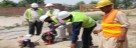 3
3 4
4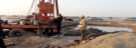 5
5 6
6